Showing posts with label Erie Canal. Show all posts

Friday, July 7, 2017

Schenectady's Colorful Canallers

This post is written by SCHS library volunteer Diane Leone

The Erie Canal running through Schenectady. This sketch is from
the December 1873 issue of Harper's New Monthly Magazine.
The Erie Canal was one of the country’s most ambitious engineering undertakings. Completed in 1825 after eight years of construction, this marvel connected Lake Erie with the Hudson River, thus opening up the untapped resources of the Midwest to the East coast, which sent both immigrants and manufactured goods west. Although scoffers called the original canal Clinton’s Ditch, it very quickly proved its value, and by 1865, more than 7,000 boats traveled its waters. The waterway was enlarged to accommodate heavier traffic, once in 1862 and a second time in 1895. Eventually the mechanized Barge Canal, completed in 1918, replaced the original canal with its towpath. Still, the “Roaring Giddap,” as the canallers called the horse- and mule-powered canal, left an indelible imprint on the history of the nation.

Along with other cities and towns on the canal, Schenectady was part of a rich store of stories—some tall tales—and songs about those who made their living on the Erie. These canallers, primarily men, were a rowdy lot. As noted canal historian Lionel D. Wyld states in Boaters and Broomsticks: Tales and Historical Lore of the Erie Canal:“They drank deeply, they ate heartily, they fought eagerly, and they sang lustily” (79). After all, they worked long hours at physically demanding jobs in a competitive, even aggressive atmosphere, with hours of monotony punctuated by stops at canal towns which offered ample liquor and other forms of entertainment.

The Craig Hotel in Niskayuna was a popular stop on the hotel. This photo shows owner Jack McPherson behind the bar. Courtesy of the Grems-Doolittle Library and Archives photo collection.
  
Drinking and fighting seem to have been the two chief activities of these boatmen. The literature is rife with examples of canallers’ fondness for spirits, although this reputation derives partly from authors, such as Walter D. Edmonds, known for popularizing the canal in fiction. In Low Bridge! Folklore and the Erie Canal, Wyld includes an iconic song, “E-RI-E Canal, with the apt refrain:

O the E-ri-e was a-rising, And the gin was getting low, And I scarcely think we'll get a drink ‘Till we get to Buffalo, ‘Till we get to Buffalo.  (101)


As Lawrence Naylor notes in The Effects of the Erie Canal on Schenectady, “A boater could get off at Union Street, race down Wall Street to Lou Barhydt’s for a jug of rum, and, if he didn’t stop to sample the merchandise, could dash down Wall Street and hop back aboard at State to continue their journey west” (15). Wyld relates the amusing tale of a boater who brags to the bartender at McClare’s Hotel in Rexford that he can, “…down a gallon of hard cider without taking more than three breaths” (Boaters 45). When the barkeep agrees to the wager, the boater disappears for a few minutes. Upon his return, he chugs down the gallon of cider provided by the bartender.

“Didn’t think it could be done,” he [the bartender] told the canaller, shaking his head in doubt over what he had just seen with his own eyes. The Erie boater wiped his mouth with his sleeve. “T’ tell the truth, neither did I,” he answered with a satisfied grin, “’til I run down to yer neighbor tavern t’ find out!” (Boaters 45)


Alcohol was not only a means of relaxation, but also served as compensation or inducement for preferential treatment. Packet boats, which carried passengers, traveled day and night, and captains were under pressure to reach their destinations quickly. The fourth verse in the song, “Raging Canal,” makes this clear:

The Captain told the driver to hurry with all speed---And his orders were obeyed, for he soon cracked up his lead; With the fastest kind of towing we allowed by twelve o’clock, We should be in old Schenectady right bang against the dock. (Wyld, Low Bridge! 91)


Henry Heilbronner owned a successful
 wholesale liquor store on State Street. 
There's a good chance the bribes for the 
locktenders came from Heilbronners.
Courtesy of the Schenectady History Museum.
Travelers were known to bribe canallers with whiskey to accelerate the boat’s speed through the canal, although vessels traveling faster than four miles per hour risked being fined, since the resulting wakes could damage the canal walls. Boatmen offered liquid tips to the locktenders—who wielded quite a bit of power—to speed up their time in the locks with a surge of water. A captain on the wrong side of the locktender, however, might find his boat unexpectedly bumping up against the sides of the lock.

Given the rate of alcohol consumption, canallers had a reputation for aggressive behavior. To some extent, this was an occupational qualification. Given the busy canal traffic, waiting time for entry into the locks was often long. Delays were bad for business, particularly for packet lines, which had preference over freight boats going through the locks. Competition existed even among packet crews. It was important for a captain to count among his crew intimidating men who could physically enforce their claims. To that end, captains were often handy with their fists, and hired men known as successful brawlers.
An example of an early lock on the canal. Courtesy of the
Albany Institute of History and Art.


Cities such as Buffalo and Watervliet had reputations as places where fighting was rampant. In fact, in the 1860’s, a two-mile area on the Buffalo waterfront was viewed as the “wickedest street in the world.” Apparently, Schenectady was also a hub for scrappers. Referring to the canal around 1850, a 1922 Gazette article, “Schenectady Was One Bright Spot on Erie Canal,” noted that the opening of the canal season in the spring brought the first fight of the season, “…where every quarrel or grudge contracted on the trip between Buffalo and Albany among canal men was fought out” (14). This maiden contest took place in a large open area on Dock Street—now Erie Boulevard—midway between State and Weaver Streets. The contestants were required to be sluggers of great distinction, whose animosity toward each other was stoked by the canallers. The battle ended only when one fighter indicated that he had had enough, which often occurred only after he was in rather dire shape. Following this spectacle, the crowd would proceed to a drinking establishment on Robinson Street where the victor bought drinks for the spectators and the loser, and the imbibing continued, “…until everyone in the party was unable to stand” (14).

So concerned was the city’s governing body about the influence of canallers on the students of both Union College and the attached grammar school that they extended the force of existing laws, which prohibited luring youth into “the vice of gaming” and providing them with “wine or spiritous liquors.” Jeanette Neisuler notes in her article, "When Schenectady and the Erie Canal Were Young," that the city fathers also had the canallers in mind when they enacted other laws, including the following: “If, when there shall be an assemblage of persons at or near any railroad or canal within the bounds of the police district in this city, any one of them shall audibly utter profane or obscene words…” (154), the perpetrator will incur a fine of $25.
Photo of a barge in the canal with Dock Street on the left. Courtesy of the Grems-Doolittle Library and Archives photo collection.

Along with those who made their living working the boats, the canal generated a variety of auxiliary jobs. The runner, often a youth, was tasked with convincing passengers to choose the packet line for which he worked. It seems that Schenectady’s runners were so competitive that this piece of the canal was called “The Battleground.” Wyld includes a report from a passenger from Saratoga, who observed the antics of competing runners on Dock Street. As their sales pitches turned to insulting their rivals, there arose quite a brouhaha:

With fists flying, the hawker for the Dutch Flyer ploughed into the Will ‘O’ Wisp man and the fight was on.  The Saratogian reported that everyone in sight joined in—it was anybody’s fight.  Three participants were pushed into the canal but kept on fighting all the same. Some canallers were jailed, but the battlers earnestly continued the brawl in the lockup (Boaters 43).


The Great Wardrobe on the canal in 1894. This photo was taken west of Schenectady. Courtesy of the Grems-Doolittle Library and Archives photo collection.
This image gives you a good idea
of how low the lowbridges of the
canal were. Courtesy of eriecanal.org
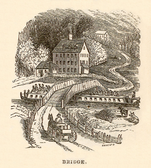
For packet boat canallers the safety of their passengers was important. Numerous bridges spanned the canal, often crossing farmland bisected by the Erie. The many travelers who took some fresh air on the roof of the packet boat cabin were in danger of suffering serious, even mortal, injury if they did not heed the canaller’s warning of "Bridge!" or "Low Bridge!" Neisuler mentions an 1835 Amsterdam newspaper report of a rather gruesome accident. A young woman traveling between that city and Schenectady was reading in an inclined position to avoid head exposure, when the vessel passed beneath an especially low bridge: “…before she had an opportunity of discovering her danger, her head was caught and crushed in a horrid manner, between the timbers of the bridge and the trunk on which she was leaning….” (157).

Accidents were common among canallers as well. Schenectady chronicler Larry Hart notes that mishaps were a daily occurrence in Old Dorp; along with injuries from low bridges, they included drownings, heat prostration, mangled limbs, and strangulation by ropes. Wyld offers several examples of these unfortunate events, including an incident in which the rope line of a grain boat near Two-Mile House in Rotterdam wrapped around a boater’s leg, dragging the vessel and nearly severing the man’s appendage. As the author relates, the victim was brought to the nearby hotel, “… and given a good supply of spirits until the doctor came to complete the amputation” (Boaters 110). Another accident on the enlarged and deepened canal was the result of a leaky boat—not an uncommon occurrence—which carried a cargo of rock salt. As the craft began to sink between Schenectady and Niskayuna, the captain used an axe to cut open the stable roof to save the mules.
           

Some locktenders on shore spied the woman and shouted to the captain.“Never mind those mules,” they hollered, “get that old lady off the boat before it goes down!” The boater kept hacking away. “These mules cost money,” he shouted back. “I can get an old lady anyplace!” (110)


As some of the stories related above indicate, canal life generated a rich body of traditional tales. Among many others were yarns about an incredible strong Bunyanesque character named McCarthy, the giant squash of Palmyra, the Rome area’s giant frog, and mosquitoes from the swamps west of Utica. Another Schenectady tale involves the winds that often blew women’s skirts up as they crossed the numerous bridges spanning the canal. From this embarrassing situation arose a story from the end of the nineteenth century, about a lovely woman attired in quality clothing and a “…wide-brimmed blue velvet hat, topped by a black ostrich feather.” When a stiff wind blew her hat into the canal, she ran away in a confused state. “The boaters and dock workers who watched her broke into loud guffaws, for along with that beautiful hat, proud ostrich feather and all, the pesky canal wind had lifted her auburn hair clear off her head, revealing a now wigless, grey-haired older woman” (Wyld, Boaters 44).

Those who made their living on the canal were a colorful group of characters, who worked and played hard, and made the Erie Canal era the fascinating period that it was and an integral part of the life of Schenectady and an expanding American nation.

Works Cited: 

Neisuler, Jeanette. "When Schenectady and the Erie Canal Were Young." New York History, vol. 35,   no. 2, Apr. 1954, pp. 139-58.

"Schenectady Was One Bright Spot on Erie Canal." Schenectady Gazette, 4 May 1922, p. 14.

Wyld, Lionel D. Boaters and Broomsticks: Tales and Historical Lore of the Erie Canal. Utica, North   Country Books, 1986.

Wyld, Lionel D. Low Bridge! Folklore and the Erie Canal. Syracuse, Syracuse University Press, 1962.

Wednesday, May 3, 2017

Odors of the Erie in Schenectady

A photo on our New York Heritage Digital Collections page prompted an interesting question, "What did the Erie Canal Smell Like?" The photo, seen below, shows part of the canal towards the end of its lifespan, probably in the late 1910s. The amount of trash and debris in the photo makes me think that it didn't smell all too great.

Photo of men on Dock Street by the Erie Canal. This photo gives a great idea of just how shallow the canal was, it was originally 4 feet deep and 7 feet after it was enlarged. Check out a zoom-able image on our NY Heritage page. Photo courtesy of the Grems-Doolittle Library Photo Collection. 
Former Schenectady City Historian William B. Efner wrote an account of his time as a cash boy in Barney's Department Store in the 1880s. Efner states that Canal would slow to a trickle in the fall as the water was let out. In the springtime, cleaners would go down into the canal and clear out any garbage, waste, and dead animals that had accumulated over the winter. Efner goes on to say that this was all thrown onto the towpath for days "until water was let into the canal and a scow could be run through on which the filth was deposited and hauled away, but the stench remained for days afterward."

Another photo of the drained canal. near the Union Street bridge Crossing. Check it out in our NY Heritage Collection.

No dock rats in sight in this picturesque postcard of Dock Street
and the Erie Canal. Check it out in our NY Heritage Collection.
Courtesy of the Wayne Tucker Postcard Collection.
Author Jeannette Niesuler wrote a six-part article on the Erie Canal from the Daily Gazette titled "When Schenectady and the Erie Canal Were Young Together." Niesuler describes the "out of sight, out of mind" philosophy that many canalers abided by when disposing of their waste. There were also sewers that let out into the canal. Neisuler goes into a bit more detail about the type of waste found by the so-called "dock rats" which was the name for the men who cleaned out the canal. Neisuler writes a very vivid description of the type of debris the dock rats would find, "Waste of all description, and some that would defy description, gathered there -- no excepting carcasses of long dead, putrefying animals, even on occasion, a horse. Lying there on the towpath, fermenting in the hot sun..." Mike Rowe would have had a field day joining the dock rats for a Dirty Jobs: Erie Canal Edition.  

Schenectadian Benedict R. Hatmaker had quite a few ideas on how to improve the city he writes that "The canal should cease to be a cesspool and a stench and turned into a crosstown street,"
Testimony of Francis Tauriello in the case of Michael Crage v.
the City of Buffalo in 1933. Courtesy of Google Books.
 which it eventually turned out to be a true prediction. Other cities were dealing with the same problem. An article in the May 6, 1913 issue of the Utica Herald Dispatch states "Neither bar spices, perfume, or chloride of lime will sweeten canal's breath." In Buffalo, a possible solution to the offending odor of the Erie was found in diverting the sewers underneath the canal and into the Buffalo River. Which solves the problem of a polluted Erie Canal, but creates the problem of a polluted river. There was even a lawsuit brought against the City of Buffalo in 1933 by a Michael Crage. Crage claimed that a lack of sewers while Buffalo was filling in the Erie Canal drove tenants away from his building.

Filling in the canal meant that many of the first floors of buildings on Dock Street were covered up. Check this image out on our NY Heritage page. Courtesy of the Grems-Doolittle Library Photo Collection.
Schenectady, like other cities in New York, found a solution to the stench by filling the canal in and creating a street. The canal in Schenectady was filled and paved in 1925, creating Erie Boulevard. The street that ran along the canal, Dock Street, is now the sidewalk of Erie Boulevard. Many of the remaining buildings along Erie Boulevard are reminders of the canal in the city although some have been demolished or destroyed over time (some very recently).

The Grems-Doolittle Library and Archives has many photos of what life was like on the Erie Canal and we have been working to digitize many of them on our New York Heritage Collection page. Images of the canal can be found in our Erie Canal Photograph Collection, Schenectady, NY Street Scenes Collection, and the Wayne Tucker Postcard Collection. For even more photos and information, stop by our library at Schenectady County Historical Society headquarters at 32 Washington Ave.

Friday, February 6, 2015

Early Railroads and a Canal...in Scotia?

Detail of map A Map of Scotia Estate, Late the property of John Sanders, Esquire, now deceased: According to a survey thereof, made preparatory to a partition between Robert, Jacob G., Peter, and Theodore W. Sanders, Sons and heirs of said deceased, Pursuant to his last Will & Testament by James Frost, Surveyor, dated December 13th, 1834.  Image from Glen-Sanders Papers, collection on microfilm in the Grems-Doolittle Library (originals at New-York Historical Society in New York City).


This blog entry is written by Schenectady County Historical Society Trustee John Gearing.

The Society is fortunate to have the Glen-Sanders Papers in its microfilm collection (comprising 18 reels, the original documents are in the collection of The New-York Historical Society in Manhattan). Toward the end of Reel 18, one finds a collection of maps and surveys that shed much light on a critical period in Scotia's history. The first item is a field book and survey map from 1834 made by James Frost, showing the lands of the Scotia Estate belonging to the late John Sanders, Jr. and their division between his heirs: Charles, Peter, and John. This is the earliest map of the Scotia Estate the Society possesses. The map not only shows which parcels were to go to which heirs, but the ownership of those Estate lots that had been conveyed prior to John Sanders Jr.'s death, which may make it interesting to those tracing their family history in Scotia.


Overall view of Frost map of Scotia Estate, as seen on the microfilm reader. Image from Glen-Sanders Papers, collection on microfilm in the Grems-Doolittle Library (originals at New-York Historical Society in New York City).


Two of New York's early railroads are also shown: the Schenectady and Utica and the Ballston and Saratoga Railroad. There is an annotation on the map beneath this last-mentioned railroad noting that “the True nature and style of this is Saratoga and Schenectady Rail Road.” The Saratoga and Schenectady Railroad was New York's second line after the pioneering Mohawk-Hudson. Chartered in February 1831, the Saratoga and Schenectady line only reached as far as Ballston initially, which may have influenced Frost's label on the map. The rest of the line to Saratoga was quickly completed, and horse-drawn service between Schenectady and Saratoga began in the summer of 1832. The railroad's first steam engine, the Davy Crockett, was a revolutionary six-wheel design by the railroad company's chief engineer, John Jervis. It entered service in July of 1831. Because of the bridge's weight limitations, railroad cars were drawn by horses through Schenectady and across the bridge, where they were then coupled to the Davy Crockett. The Frost map shows the location of the engine house near the Scotia end of the bridge.

The other railroad shown on the map, the Schenectady and Utica, stands out in New York railroad history as the first line that posed a threat to the Erie Canal's freight business. Chartered in 1833, the line did not begin service until 1836. Its appearance on the 1834 Scotia Estate map likely indicates that construction from the Schenectady end was well underway by that time. Interestingly, although the map shows both of the rail lines sharing the Mohawk Bridge, it also appears to show a railroad right of way (unlabelled) departing from the Schenectady and Utica line in a graceful curve and terminating on the north bank of the Mohawk River roughly where the railroad bridge stands today. This may indicate that the construction engineers were planning on building a new bridge across the Mohawk, one that would have been strong enough to carry trains pulled by steam locomotives. The threat to the Erie Canal's freight business was such that the Schenectady and Utica was forbidden by law from carrying freight until 1844, and then it was only allowed to carry freight in the winter months and then only upon the railroad paying freight tolls to the canal company.


Detail of Frost map showing the labeling of Ballston-Saratoga Railroad, Warme Killtie, New Canal, and Lower Ferry Road. Image from Glen-Sanders Papers, collection on microfilm in the Grems-Doolittle Library (originals at New-York Historical Society in New York City).


Perhaps the most curious feature on Frost's Scotia Estate map is the structure labeled “New Canal.” The map shows a canal running easterly, parallel to and approximately 275 feet north of a road marked “Lower Ferry Road.” Sunnyside Road is the most likely candidate for this road today. The eastern end of the canal appears to end just slightly south of the intersection of today's Freeman's Bridge Road and Maple Avenue. The canal extends across both railroad lines, appearing to terminate slightly west of the Utica and Schenectady line. A stream labeled “Warme Killtie” runs south to a point about 200 feet north of the canal, and then turns easterly and runs roughly parallel to the canal. A short canal section branches from the New Canal and connects to the Warme Killtie at the point where it begins it's turn to the east, suggesting that the Warme Killite was at least a major source of water for the canal. Further up the Warme Killtie the map shows a millpond and mill, raising the likelihood that there was an intention to float the mill's products down the stream to the canal. Once on the canal, freight could have been carried west to the railroad crossings, or east to the highway junction. A map notation indicates that about 3,700 feet of the canal had been completed at the time the survey was made.


Contemporary image of portion of area shown on Frost map of Scotia Estate. Remnants of the "New Canal" can be seen running parallel to Sunnyside Road and along modern railroad  tracks. Image from Google Maps


Comparing this 1834 map with a contemporary Google map and satellite image, one finds a body of water that is almost certainly the canal, running parallel to and about 275 feet north of Sunnyside Road. The Warme Killtie can be made out, although now it no longer continues eastward. Instead, it now appears to connect to the surviving canal. Intriguingly, the Google map and images suggest that today the body of water that was the canal, continues westward, closely paralleling the modern railroad line (just to the north), nearly to the intersection of Route 5N and I-890. This raises a question: was there an attempt to build a canal system in Scotia prior to the development of railroads? Some accounts recall the disappointment felt by Scotia residents when the Erie Canal was routed through Schenectady instead of Scotia. The Scotia canal may have been intended to extend eastward as far as Rexford, and there connect with the Erie, or could have even been planned to cross the Mohawk River at Freeman's Bridge via aqueduct and connect with the Erie on the south shore. Consultation of Scotia histories and Google searches have so far failed to lead to any additional information about Scotia's canal, leaving a tantalizing subject for further research.

Thursday, December 18, 2014

Christmas and the Erie Canal in Schenectady


Youngsters ice-skate on the frozen Erie Canal in this photograph taken circa 1910. The skating area, just south of State Street on what is now Erie Boulevard, was a popular place for children and families to have fun during the holidays. On the weekends before Christmas, lanterns and music were brought in to make skating an even jollier affair. Image from Grems-Doolittle Library Photograph Collection. 


Larry Hart wrote in his "Tales of Old Dorp" newspaper column in 1980 that local resident Lew McCue, who grew up in Schenectady and worked on the canal in his younger days, "had a canal story or poem for almost any occasion." Christmas was no exception. McCue shared with Hart his memories of Christmas days during the canal era.


This image of Lewis "Lew" McCue, circa 1950, was taken by Schenectady Gazette photographer Ed Schultz. McCue, who shared his memories of the Erie Canal with local historian and newspaper reporter Larry Hart, died in 1965 at the age of 82. Image from McCue surname file.   


McCue shared his memories of his 1880s boyhood in Schenectady; he credited the canal with making the Christmas season brighter. Special and exotic goods arrived in Schenectady, brought to town by shippers operating on the canal, right before the November closing of the canal each winter. These shipments made fruits such as bananas, oranges, figs, grapefruits, and pineapples plentiful during the holiday season. The canal barges also brought wine, cheeses, nuts, ginger, molasses, books, hardware, cloth, and stationery from faraway places. While everyone appreciated these special goods flowing into town just in time for the holidays, McCue noted that those who remembered life in Schenectady before the canal opened in 1825 were especially awed by the range of goods that the canal made it possible to be brought into town.


In this image of the Erie Canal, taken from the State Street canal bridge sometime before 1887, barges can be seen lined up along the warehouses that lined the canal. Just before the closing of the canal each November, barges would bring large shipments of goods up from New York City wholesalers, just in time for the holiday season. Image from Grems-Doolittle Library Photograph Collection. 


The canal also offered a special holiday delight in the form of recreation. On the weekends just before Christmas, McCue remembered, Schenectady's merchants provided funds to have Japanese lanterns hung along the ice skating area of the canal (the area just south of State Street on what is now Erie Boulevard), and hired bands to perform music for the skaters. Wintertime horse races were also held along a mile length of the canal from the Washington Avenue bridge westward.


Local men bundle up to watch horses race on the frozen bed of the Erie Canal in this undated photograph. Horse racing and ice skating were popular wintertime pursuits along the canal; Lew McCue especially associated these activities with Christmastime in the area. Image from Grems-Doolittle Library Photograph Collection. 


While local kids used the canal for ice skating, they also imagined that the canal provided a means for Santa Claus to hasten his travels across New York State. McCue shared with Hart that the children in Schenectady in the late 1800s believed that, rather than traveling with flying reindeer in the sky, Santa Claus' reindeer drew his sled along the frozen canal.

While a youth working on the canal, McCue also learned a holiday song from other canal workers, the lyrics of which he passed along to Larry Hart, who published them in his "Tales of Old Dorp" column:

There was always a Santa Claus on the Erie Canal, 
Mrs. Claus powdered her nose and joined in as well. 
There were cargoes of spice, nuts and logwood for toys, 
And many other things for girls and boys, 
And tons and tons of molasses, with a Christmas smell. 
Yes, there was always a Santa Claus on the Erie Canal.

Tuesday, October 21, 2014

The Rise and Fall of Schenectady's Wall Street

This 1850 Schenectady city map shows the single block of Wall Street, running parallel to the Erie Canal between State Street and Liberty Street. The Givens Hotel was located on the east side of the street. Image from Grems-Doolittle Library Map Collection. 


Schenectady's Wall Street has its origin from around the time that the "third stockade" was constructed in Schenectady around 1776. The street ran along the inside of the eastern wall of the stockade, connecting Front Street and State Street. In the street's early years, the entire stretch of street was called Wall Street. After Union College established its building on the street, the section between Union Street and Green Street became known as College Street. The part of the street north of Union Street was briefly named Elbow Street before becoming a part of College Street as well.


This map shows the locations of three stockades built around the settlement at Schenectady, overlaid on a modern map of the modern Stockade Historic District. The location of Wall Street can be found along the eastern edge of the third stockade, built around 1776. Image from Colonial Schenectady in Maps by Susan Staffa (1983). 


In 1825, the construction of the Erie Canal cut Wall Street down even further. The section of Wall Street west of the canal also became a part of College Street, and Wall Street was reduced to a single block, running between State Street and Liberty Street. Although the street was small, its proximity to the railroad tracks and the Erie Canal made it a bustling little street. Businesses along that section of the canal set their storefronts on Wall Street and drew merchandise from barges on the canal side. The early 1840s saw the construction of a railroad station and the Givens Hotel there.


This view of State Street from the 1880s shows railroad tracks in Schenectady when they were at the street level. In the center of the photograph is Givens Hotel, which stood on State Street between the railroad tracks to the east and Wall Street to the west. The entrance to Wall Street can be seen behind the Givens Hotel in this image. Image from Grems-Doolittle Library Photograph Collection. 


Although it was busy, its proximity to the railroad and canal did not make it a pretty place to do business. Historian Larry Hart wrote that by the late 1870s, "the east side of Wall Street was not too pleasant a sight. Clustered near the grade level crossing at State Street were a shabby little restaurant and saloon, weatherbeaten sheds and wood fences, grimy with wood soot." Wall Street blossomed in the 1880s. The a new railroad depot opened there in 1882; the Givens Hotel was demolished and the Edison Hotel was erected in its place in 1889. A right-of-way along the railroad tracks north of Liberty Street was tacked on to the end of Wall Street to accommodate the Central Arcade, a complex of 20 shops and offices.


This 1889 photograph shows the area once occupied by the Givens Hotel at the corner of Wall Street and State Street, before the Edison Hotel was constructed in its place. The row of businesses that ran along Wall Street can be seen at left, and Schenectady's train station can be seen in the rear center of the photograph. Image from Grems-Doolittle Library Photograph Collection. 


However, changes in the community changed the fate of Wall Street. The elevation of the city's railroad tracks in 1905 affected Wall Street profoundly, as it went from being a bustling street to a side street. Wall Street suffered another blow as Erie Boulevard replaced the Erie Canal in 1925. Businesses which had formerly had their storefronts on Wall Street now changed to face Erie Boulevard. In the early 1970s, the buildings which once ran along Wall Street were demolished to make room for additional downtown parking. Today, the street no longer exists.


This view of Wall Street in January 1971 looks south toward State Street. The Crown Hotel, at left, was demolished later that year, along with a number of other buildings along Wall Street. The side of the former railroad station, which had closed in 1969, can be seen at the far left. It was also demolished in 1971. Image from Grems-Doolittle Library Photograph Collection. 

Thursday, June 12, 2014

From Erie Canal to Erie Boulevard


A serene view of the canal era in Schenectady. This drawing appeared in Harper's New Monthly Magazine in December 1873, as part of a piece on "The Waterways of New York." 

The area now occupied by Erie Boulevard in Schenectady is just one of the places in the city that, in looking back, the changes wrought by time are very apparent. We've selected a few trios of photographs that showcase the transformation of the Erie Canal from a nineteenth century waterway, to a drained canal under construction into a road, to the busy Erie Boulevard of the mid-20th century. Enjoy these images that show the changes to transportation, commerce, and community life in Schenectady.

Erie Canal looking north from State Street toward the Liberty Street bridge, ca. 1900. Image from Grems-Doolittle Library Photograph Collection. 
In this photo, you can see the drained canal -- from State Street to the Liberty Street bridge -- partially filled in in preparation for the construction of Erie Boulevard. Image from Grems-Doolittle Library Photograph Collection. 
The bustling corner of Erie Boulevard and State Street, ca. 1950, looking north toward Liberty Street. Image from Grems-Doolittle Library Photograph Collection.  


This image, ca. 1896, shows the Erie Canal looking south from State Street. The road that ran alongside the canal was referred to as Dock Street. Image from Grems-Doolittle Library Photograph Collection. 
The drained Erie Canal as it began to be filled in, looking south from State Street, 1917. Image from Grems-Doolittle Library Photograph Collection. 
Erie Boulevard in 1937, looking south from State Street. The General Electric plant is clearly visible in the distance, and the cars of shoppers are parked in front of local businesses. Image from Grems-Doolittle Library Photograph Collection. 


This undated photograph shows the Erie Canal below State Street, looking north toward the State Street bridge.  Image from Grems-Doolittle Library Photograph Collection. 
The drained Erie Canal, just south of the State Street bridge, as it was being filled in. Image from Grems-Doolittle Library Photograph Collection. 
This 1950s image shows Erie Boulevard south of State Street, looking north toward State Street. Image from the Grems-Doolittle Library Photograph Collection. 


Friday, July 5, 2013

Celebrate the Erie Canal in July


This postcard image of Dock Street along the Erie Canal in Schenectady, ca. 1910, illustrates the canal as a site of commerce and industry, as well as pleasure. Image from Grems-Doolittle Library Postcard collection. 

On July 4, 1817, construction began on the original Erie Canal at Rome, New York. The construction of the canal was an extraordinary feat of engineering as well as state-sponsored economic development, and it had a great impact on trade, transportation, and the development of cities and rural communities that ran along its route from Albany to Buffalo. The Grems-Doolittle Library has recently compiled a guide to sources about the Erie Canal in our Library that includes books, photographs, oral histories, original documents, and other materials. The research guide can be found by clicking this link. Come in and visit us to find out more! We've also included a few Erie Canal-related tidbits below for you to enjoy.

Erie Canal enthusiasts might also want to check out a new exhibit at our Mabee Farm Historic Site in Rotterdam Junction, in the Nilsen Dutch Barn. The exhibit, The Erie Impact: Changing Agriculture in the Mohawk River Valley, highlights the changes that occurred on farms along the Mohawk after the construction of the canal. The Mabees and their neighbors shifted from cash crops like corn and wheat to specialized products like dairy, orchard fruits, and vegetables. This is a chance to see some of the wonderful agricultural and cooking tools found in the Mabee Farm collection.

The history of the Erie Canal also comes alive on July 20, 2013 at the Mabee Farm Historic Site with a program "After Erie: The Impact of the Erie Canal on Mohawk Valley Agriculture." This family-friendly event will feature hands-on activities and exhibits highlighting the changes the Mabee Farm and its neighbors along the Mohawk River underwent because of the construction of the Erie Canal. Focusing in on broomcorn, hops, the orchard, and the vegetable garden, visitors will have the chance to see if they have the skills to be an 18th Century farmer, brewer, broom maker, or cook.

If you have any questions about this upcoming event or the exhibit, please contact our Assistant Curator / Educator, Jenna Peterson, at educator@schenectadyhistorical.org or by phone at 518-887-5073, ext. 104.


Ice-skaters enjoy the frozen Erie Canal in Schenectady, just south of State Street, circa 1910.  Photograph from Grems-Doolittle Library Photograph Collection. 

Erie Canal weigh master's bill dated June 20, 1879. It was issued by Thomas Riley, weigh master at the West Troy weigh lock, for the boat John W. Hall of Whitehall. At that time, boats on the canal were weighed and a toll charged according to their weight. From Grems-Doolittle Library Documents Collection. 

Picture postcard of the Erie Canal through Rotterdam. From Grems-Doolittle Library Postcard Collection. 

The enlargement of the Erie Canal was necessary to accommodate canal traffic, but not everyone was happy with the process. This note from the Mabee Family Papers (M-LM-43) estimates damage to the property of Simon and Sarah Mabee in Rotterdam Junction due to the enlargement of the canal at $150.00. The damage to the property is identified as damage due to riding over the soil and the destruction of fences. 

Travelers on board the Kittie West, an excursion boat that transported passengers between Schenectady, Rexford, and Vischer Ferry. Photograph from Grems-Doolittle Library. 


Friday, November 12, 2010

Mabee Family Papers

Biographical Note:
In 1705, Jan Pieterse Mabee acquired the land where the Mabee Farm Historic Site stands today. Originally settled by Daniel Janse Van Antwerpen, the site served as a fur trading post for American Indian traders. For 287 years, the Mabee farm was passed down through the generations, and today is the oldest house standing in the Mohawk Valley.

George E. Franchere
In 1993, the last family owner, George E. Franchere, gave the Mabee farm to the Schenectady County Historical Society, along with furnishings, heirlooms, and family papers.  Today the Schenectady County Historical Society continues to develop the farm site as a museum and educational center for the community.

Description of Collection:
This collection consists of almost 600 items including deeds, wills, letters, inventories, legal documents, bills of sale for slaves, and receipts.  The Mabee Family Papers provide a wealth of information that the Historical Society utilizes in developing interpretive programs for the farm.

1. Accounts (ACCTS)
Various bills, 1756-1895

2. Architectural Drawings (ARCH)
Historical American Buildings Survey, 1936

3. Church (CH)
Various church related items, including the purchase of a church stall or seat

4. Civil War (CW)
Documents relating to the Civil War

5. Deeds (DEEDS)
More than 50 documents relating to land transfers

6. Dutch (DUTCH)
Variety of documents, letters, etc. written in Dutch

7. Genealogy (GN)
Variety of Mabee family genealogy items

8. Insurance (INS)
Items relating to insurance on the farm

9. Inventories (INV)
Inventories made for estates of Jacob Mabee, 1824; Eve Mabee, 1863 & Simon Mabee, 1880.

10. Legacies (LEG)
Acknowledgments of receipt of legacies

11. Legal Matters (LM)
Acknowledgments of receipt of legacies

12. Letters (LETTERS)
Promissory notes, mortgages, court actions, documents relating to patents, summonses and bonds

13. Maps (MAPS)
Hand drawn and printed maps

14. Military (MIL)
Appointments, commissions, plus a number of items relating to deficiencies at company inspections, ca. 1806

15. Miscellaneous (MISC)
Variety of papers and documents

16. Periodical Clippings (PER)
Clippings from magazines and newspapers

17. Poems (POEMS)
Four undated, hand-written poems, authors unknown

18. Receipts (RECEIPTS)
Variety of receipts--many are for "payment on account" so do not give information on what was purchased

19. Slaves (SLAVES)
Bills of sale for slaves owned by the Mabee family

20. Student Exercises (STUDENT EX)
Practices exercises is calligraphy and arithmetic

21. Wills (WILLS)
18th and 19th century wills  


Wednesday, October 6, 2010

Larry Hart Collection


Dates: 1792- 2004
Volume: approx. 51.87 cf
Creator: Larry Hart

Larry Hart (1920-2004)
Biographical Note:
Larry Hart was born Clarence William Hart in Schenectady, NY on March 17th, 1920. Hart attended Schenectady public schools and started Union College in 1940, leaving in that year to join the armed services. Larry Hart served with the 357th Squadron, Eighth Air Force in Europe during World War II. In 1943, he worked as an aerial photographer and photo reconnaissance technician.

Hart became a full time photographer and reporter for the Union-Star in Schenectady, NY in 1945. In 1960, he became a reporter for the Schenectady Daily Gazette where he remained a columnist until his official retirement in 1980, although he continued to write freelance. His farewell note was published on March 20, 2000. A political reporter, Hart is probably best known for his historical column, “Tales of Old Dorp” which first appeared in the local section of the Daily Gazette on May 14, 1974, and ran through the 1990s.

Larry Hart served as President (1965-1968 and 1979-1981) and trustee (1962-1983) of the Schenectady County Historical Society. Hart was both Schenectady County Historian and Schenectady City Historian. Larry Hart died on February 10th, 2004, in Schenectady at the age of 83.

Description of the Collection:
The Larry Hart Collection is more than 52 boxes of research files, photographs, documents and records about Schenectady covering the whole of the 20th century as well as earlier eras. As the city and county historian, Hart was able to collect a great variety of materials relating to the local area.

The collection is arranged by format and then topically or by date. This collection is a great tool for the researcher interested in local research topics, local oral history, genealogy, and pictorial views of Schenectady and the surrounding area. Subjects covered include American presidents, the American Civil War, ALCO, G.E Company, Charles Steinmetz, oral history, urban renewal and historic preservation.

1. Audio/Visual Materials: (3.63 cf)
A collection of 93 cassettes, 44 reel to reel, 9 film and 10 VHS tapes, mostly dated between the 1960s-1990s. Most of the cassettes seem to have been recorded by Larry Hart himself. This collection primarily focuses on interviews and oral histories of the Schenectady area. Topics include several presidential speeches (not recorded locally); WGY radio; Mayor George Lunn; and GE scientist Charles Steinmetz.

2. Books: (10.8 cf)
A collection of 110 titles. Topics include local history; Schenectady and the greater Mohawk valley; and the American Civil War.

3. Correspondence: (0.38 cf)
A collection of letters received by and sent by Larry Hart. These letters are divided into two major categories: local and genealogical questions ranging from 1966-2000 and Schenectady City/County Historian- Monthly and Annual Reports ranging from 1970-1985.

4. Documents (.57 cf)
This collection covers a wide variety of local topics, which includes 58 documents from Richmond, New Hampshire in Cheshire County, dating 1792-1826 and relating to Benjamin and David Perry. Items of interest include: A press-pass for the Ringling Bros. Circus, 1954; an Erie Canal Sesquicentennial envelope; a dance card from the eighth annual ball of Ira Van Buren Lodge, 1904; 3 war ration books owned by Hart and his family.

5. Magazines: (1.19 cf)
This collection includes several editions of various magazines of national and local interest. Included are issues of Life Magazine and several local periodicals, the Periscope from the first issue in 1915 through February of 1926, Schenectady Works News, Mohawk Valley USA. Topics of interest include: The American Civil war in New York; Eisenhower’s death; Kennedy’s death; Landing on the moon; The 355th fighter group assn. Mustang.

6. Maps: (1.98 cf)
A collection of copies and original maps of Schenectady County and the surrounding area, Erie Canal and the Adirondacks.

7. Newspapers: (1.33 cf)
A collection of originals and copies of newspapers, all locally issued except a copy of the New York Tribune about the sinking of the Titanic. Topics include: Original 1803 Western Spectator; copies of the first issue of the Gazette in 1894; Union Star 1945 about the war in Japan.

8. Oversized Materials: (0.89 cf)
A collection of documents relating to local history and Larry Hart’s personal achievements, several certificates which were presented to Hart for his work, and a scrapbook of his WWII experiences. Also reflects his wider interests in history with Civil war material. Topics include: WWII scrapbook pages from Hart’s time in the Air force; Jack Dempsey fight poster; wooden cigar box lid sketched on by Steinmetz; layout pages for book covers.

9. Pamphlets (1.36 cf)
A collection of pamphlets, covering a variety of topics ranging local, Schenectady city, county and New York State, and national history.

10. Photographs: (7.60 cf)
The Larry Hart Photograph collection contains mostly black and white pictures dating from the late 1800’s to the 1990’s with a primary concentration between the 1940’s and the 1990’s. It is arranged according to topics, which seem to correlate with the themes of his “Old Dorp” newspaper articles. The collection also contains photographs, letters, and documents contributed from other sources. Oversized photographs are also included, many of which have been enlarged from smaller prints and several of which are framed. A large collection of Carman School class photographs are among the oversized pictures.

11. Postcards: (.39 cf)
This collection includes color and black and white postcards as well as some photo postcards. A number of postcards have handwritten messages, are stamped by the Post Office, and include the name of the addressee. The dates on the postcards range from the early 20th century up to the 1980s. Topics include: Holidays: Thanksgiving, St. Patrick’s day, Valentine’s day, Christmas and New Years; various Schenectady city sites including General Electric, American Locomotive Co., parks, the circus fire of 1910 and Union college ; Schenectady County sites including Albany, Rotterdam and Amsterdam; out of area sites including Washington D.C. and New York City and views of the Hudson River.

12. Research Files: (11.77 cf)
A collection of documents, newspaper articles and notes, sorted by topic. These files contain topics of local, state and national importance. Many of the topics were most likely compiled for Larry Hart’s “Old Dorp” articles. Topics of possible research interest include: ALCO; Susan B. Anthony; Barbers; Baseball; Brooklyn; Carnegie Hall; churches; Civil War; Dutch; Gazette; Halloween; Indians; Lynching ; George Lunn; Markers; Eliphalet Nott; Presidents; Red Cross; Rexford; Stamps; Vale Cemetery; Wall Street; World War II; Joseph Yates.

13. Scrapbooks: (2.4 cf)
This is a collection containing 20 scrapbooks and photo albums. The albums are a variety of sizes and in varying conditions. Most of these albums were compiled by Larry Hart, but seven scrapbooks were compiled by others. Two of the albums were compiled by Clarence Hart, Larry Hart’s birth name. Sometime after World War II, he legally changed his name to Larry Hart.

14. Slides: (.11 cf)
This collection includes color and black and white photos. The collection also includes several illustrations and maps, in both color and black and white. Dates of these slides seem to be the 1950-1980s with subjects ranging from approximately the late 19th to 20th century.

15. Negatives: (.96 cf)
A collection of negatives, presumably taken by Larry Hart throughout his lifetime. The collection is a compilation of both black and white and color negatives in a variety of sizes including 4 x 5 inches, 1 ¾ x 2 inches and 1 ½ x 1 inches. Topics include: Transportation; fires; car accidents; deaths; Rotary club event; several Schenectady buildings and streets.